Khandadhar is located at about 95 Km from the nearest town Rourkela. The road is absolutely smooth and takes very near the hill hosting the fall. Frome the entrance, one has to ascend about 150 steps to reach near the waterfall.
Khandadhar waterfall is located in the picturesque location surrounded by the evergreen hills. On cloudy days, the play of light and shadow assures dramatic landscapes.
The water flows down from the small natural pool situated beneath the waterfall. These streams is an interesting capture during the post monsoon season when the water is apt to produce a photograph showing a smooth-water-flow.
Valley as seen, Khadndadhar fall on the backside
A small pool naturally created by the falls is certainly great fun to take a bath in. Tourists gather in a huge number on this spot, especially during the winter months. Though pool and the nearby area seems innocent, falls has caused some deaths mostly because over enthusiastic and drunk tourists.
A complete view of the falls - to get this one has to climb down through the stream. The pool is somewhere in the mid of this photo.
Downstream
The place is an interesting place to watch flora and fauna of Odisha. During my visit in mid-August, I spotted following butterflies.
Butterflies spotted at Khandadhar:
Large Oakblue
Common Pierrot
Grass Yellow
Common Mormon
Common Leopard
Common Crow
Common Nawab
Common Banded Peacock
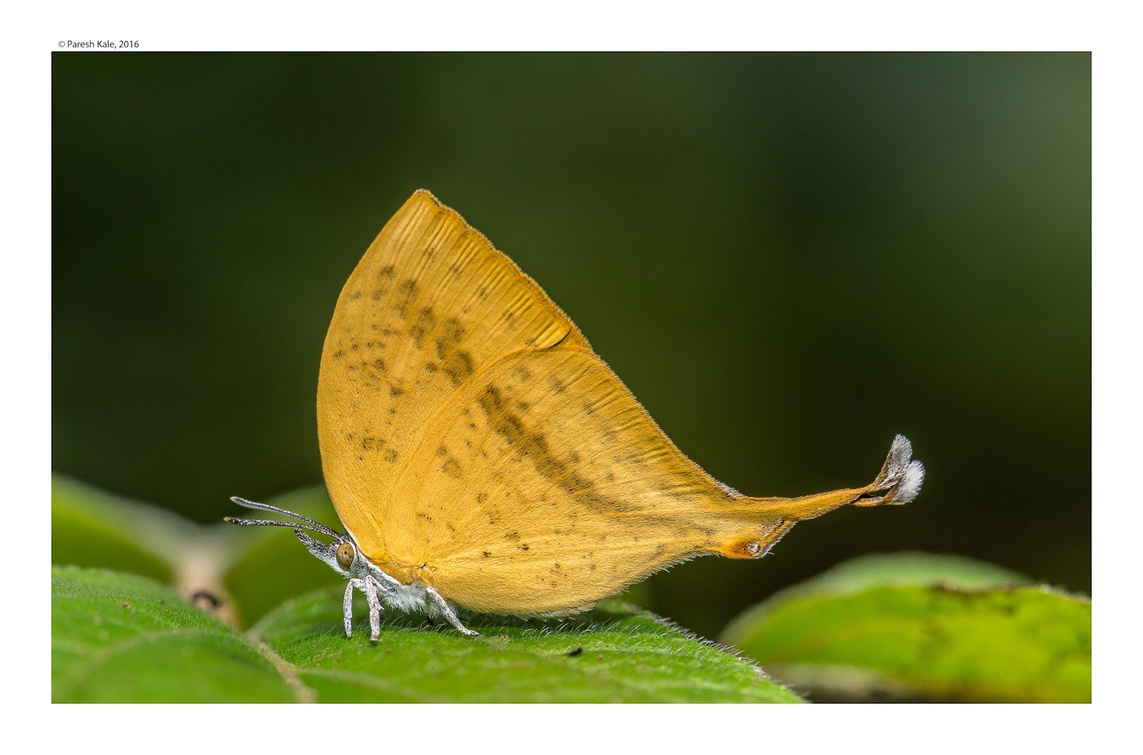
Orange Oakleaf
Blue Mormon
Yamfly
Baronet
Common Emigrant
Lime
Common crow
Great Eggfly
Chocolate pansy
Lemon Pansy
Indian Sunbeam
Staff Seargent (?)
Lineblues
Indian Nawab
Baronet
Yamfly
Robber fly
Tips for travellers:
Travelling by private or hired vehicle is the only option. No public transportation available.
No entry fee
Place near the fall is well developed as a picnic area. Though the basic facilities like toilets are missing.
It's a NO plastic zone, so please don't litter.
Be careful while attempting adventurous activity of any kind. Innocence of the water stream may be an illusion.
There is guest house of forest department and can be booked for an overnight stay.
There are NO food stalls nearby. The best way is to carry the food or prepare it onsight.
Odisha and nearby states like Jharkhand and Chattisgarh have many unexplored places and the cultures, especially one ruled by the tribal life. Among these, several locations are ending with "Buru" like Kiriburu, Meghataburu, etc. "Buru" means hillock .and the prefixes have different meaning like "Kiri" means insects. "Megahata" means cloud.
Kiriburu and its sister town of Meghahatuburu, both located in both Jharkhand and Odisha are easily accessible from most of the towns nearby. Meghataburu is one of the largest Haematite iron ore mines in the world. The famous Saranda Forest nearby these places is the densest deciduous forest in Asia.Also the largest Sal forest in Asia.
Kiriburu is a place for nature lovers, where one can watch hills and valleys full of tall ad indigenous trees and all-year-round green vegetation. The weather is usually right round the year. Even in summer months, when rest of Odisha starts feeling the increased heat, one can experience morning fog in Saranda forest. The forest receives around 200 cm(approx) of rain in Kiriburu. In Meghahatuburu, near the SAIL guest house located in a corner of the town, a beautiful view of 700 mountains in the morning, and the beautiful sunset is panoramic to watch.
Fire in these jungles during summer is a common phenomenon - cause many times manmade and sometimes natural
Saranda Forest:
Sarana forest is located in the hilly region of West Singhbum district in the state of Jharkhand. "Saranda" in local language means land of 700 hills. Another origin of the name might be due to the presence of a large number of elephants in the forest. Saranda means elephants.
The density of the forest itself is scenic to watch because it is covered with mostly a single type of tree: Saal. The calmness, wilderness, the depth all adds up to a must have experience in this part. Most of the forest is untouched and makes it a perfect home for plenty of bird and other wildlife species importantly elephants, tiger, leopards, and Bisons. It also hosts some stunning waterfalls and hill views.
The river Koena is by far the most important river of this division. It originates in the extreme south of Bhangaon village on the Bonai border. It flows for about 80 km through this division and drains into the river Koel at Manoharpur. About 1100 hectares of virgin forests with more than 40% canopy cover is under iron ore mining leases. Several new aspirants for mining lease are in the waiting.
Some interesting facts:
Allegedly, this part of India hosts many Primitive Tribal Group, who are unaware of the modern civilization e.g. people who don't wear clothes. Some tribes use sound and use sign languages. Jharkhand government has made cement houses for them within thick forest so that they can continue living amidst the woods but with some added security.
The Singh Deo family were the royal family of the Saraikela, and Saranda forest was the hunting reserve of this family. Allegedly, the royal family made money by exploiting the forest resources by selling Elephant tusks, timber, etc.
How to reach Kiriburu:
A small video of travel from Manoharpur to Kiriburu and then in the forest near Pundulu
Kiriburu and Meghataburu are very close to each other. From Rourkela, it is advised to hire car and travel by road. Limited bus service is available, but can't be guaranteed about time and regularity. Kiriburu can be reached from Tatanagar by road or by rail, the nearest railway station being Barajamda, at a distance of 24 km. The mining town of Barbil in the Keonjhar District in Orissa is at a distance of 28 km from Meghahataburu by road. Direct Train - Jan Shatabdi- from Howrah (West Bengal) is available up to Barbil. Tourists, if not willing to stay and are travelling by road, should visit only during day-time for security reasons. Barbil is the only town near by for good accomodation. Guest house at Meghataburu is only for SAIL employees.
Khandadhar waterfall is a famous tourist destination in the western part of Odisha. Horse tail type Waterfall is a 244 meters drop which secures a place to the list of highest waterfall of India. Khandadhar (Khand + Dhaar) literally means stream coming from the canyon/slit in the hill.
Pauri Bhuiya, a local tribal residing in the area near by, has an interesting story to tell about the fall. It is reproduced here from outlook:
“A Pauri Bhuiya legend speaks of how their mountains came to be so munificent. The Sundergarh branch of the community was once possessed by a rapacious goddess named Kankala Devi, who consumed trees, soil and everything else. In despair, the Pauri Bhuiya placed her on a rock, which she ate through as well—creating a deep hole from which poured out the Khandadhara (split-rock waterfall). So they had water.
Then a couple from the community went to visit relatives at the eastern, or Keonjhar, end of the Khandadhar mountain range. Their prospective hosts were away but a pile of grains had been left outdoors and, amazingly, not even the birds were eating it. Inside the heap, the couple discovered a small goddess, Khand Kumari, protector of the region’s prosperity. They stole her and brought her back to Sundergarh, and so her bounty became theirs.”
As per observations by regular visitors, the stream has reduced and apparent cause is the heavy mining in the adjacent hilly areas. The streams leading to this giant waterfall can be explored in the jungles of Khandadhar. The route to the top is different from the one which leads to the famous location of Khandadhar fall. Follow Lahunipada-Barsuan -Koira road. From Barsuan check post, turn right to reach Khadadhara Mines office.
This serene and untouched jungle is full of small streams of water flowing among the common Saal trees. Trees here can grow up-to a hundred feet straight. In the month of January when we visited, the temperature was moderate and perfect for walking around. Reaching in the early morning paid back in terms of some awesome landscapes. The best season to visit could be from November till February. Although very few visitors come to this place, it is safe for a family outing.
Interesting layers of the rocks seen around the place
Life around the valley:
Many dwellers earn bread and butter working in the mines.
A local catching the fish in the water. He overturns a rock and quickly filter the water though the net to catch the fish.
Butterflies spotted at Khandadhar:
Large Oakblue (plenty in number)
Common Pierrot
Grey count
Grass Yellow
Common Mormon
Grey Pansy
Flash
Common Cerulean
Common Leopard
Glassy Tiger
Common Sailer
Gram Blue
Common Crow
Common Pierrot at a stream
Acknowledgement:
The splendid arrangement was done Dr. Liu and Satwindarji, expert photographers from Rourkela. Students of Third Eye Photography accompanied as well. Thanks to everyone.
How to reach:
The Khandadhar Falls is 104 kilometers (65 mi) from Rourkela.
Private and sturdy vehicle must be hired. Road in some part is rough.
Vehicle must have high ground clearance. In rainy season four-wheel drive is a must.
Hockey ground near Khadadhara mine office from where a small and simple jungle walk of about 2 Km starts.
Trekking from the playground to the top (near the Khandadhara Mines office
This is one of the small but beautiful waterfalls of Sambalpur district, Odisha. It is a Cascade waterfall meaning two waterfalls back to back. Waterfall sprinkles out from the Gudguda mountain, however streams doesn't turns into any river.
It is one of the perfect family picnic spot, approachable from any part of Odisha. After October, when Monsoon recedes, limited waterflow allows visitors to enjoy cold water streams. A small stream flows through the forest and in later parts support vegetation and farming in near by villages. Fruits like Mango, Litchi, Oranges are grown around the place.
Waterfall lies on the brink of Bamra-Gangpur forest full of densely grown trees reaching about 75 feet. Surrounding jungle is a serene and ecologically diverse making it a spot for photographing most of wild species occurring in Odisha. when I visited in October, the place was full of butterflies and dragonflies. Major insect predators were the frogs in large number.
How to reach:
From Rourkela, there are two routes to approach Gudguda waterfall. Although the time taken to travel remains same, conditions (road, landscape, accessibility etc) are totally different. On both roads, road signs / milestones are totally missing. The few present are in Odiya.
This road is absolutely superb to drive. Outof 167 Km drive, first 72 Km falls on state highway 10 , which will soon become a four lane highway connecting Rourkela- Jharsuguda-Sambalpur, from Rourkela to Bargaon. In some patches work is going on either to widen or make bridges. The work is expected to complete by May 2016. Food can be founf at all the major places mentioned.
2. Rourkela - Gurundia - Kusumi Gudguda
This is a shorter (107 Km), however more scenic compared to route 1. Most of the road passes through 'Bamra-Gangpur forest range'. Patch between Gurundia to Kusumi is too bad for car. However, road can be enjoyed a lot on bike specially during rainy season. Food may be available only at Gurundia, so always carry some packed food.
Precautions:
Drinking alcohol is prohibited, but as usual, some tourists tend to enjoy it near the streams.
Do not cross the safety wires put around the waterfall.
Unless you are a good swimmer, swimming in deep water is not advisable. Many incidents of mishaps are reported from the place.
If you are cooking, take care not to be a reason to destroy the place with fire.
Facilities:
No fees for the visit
It's primarily developed as picnic location. Cooking food is allowed. Special concrete platforms are constructed for the same.
Changing rooms are available with the care-taker.
Place is approachable with any kind of vehicle. Lot of parking space is available.
Best time to visit
October to February
Approaching road to the parking area at Gudguda
List of Butterflies spotted
Common Mormon
Blue Mormon
Baronet
Chocolate Pansy
Grey Pansy
Peacock Pansy
Leopard
Common Grass Yellow
Lime
Common Emigrant
Common Nawab
Common Lineblue
Common Hedgeblue
Common Crow
Glassy tiger
Common Lascar
Common Evening Brown
Orange Oakleaf
Golden Angle
Great Egg fly
Grass Dart
Water snow flat
Oakblue species
Sailor species
Silverline species
Prof Bala and his family enjoying a dip at the waterfall
Small water streams and dense jungles make it perfect combination for photography
A particular foremost dilemma in shooting snap is: Should I
shoot portrait composition or landscape configuration. This suspicion arises in
the premature phase of learning photography. This is not at all a bad question,
rather indication that one is learning truly and intriguingly. Portrait composition means photo is vertically shot, where
height is more compared to width. Landscape composition contradicts the
portrait mode in dimensions. Aspect ratio of photograph depends on ultimate use
of photo, category of photography practiced and of course the personal taste.
Here I am listing the advantages and preferred use of both the types.
Use of landscape composition:
When the width of object is more than height e.g. A car, range of mountains
Used for landscape, documentary kind of photography
Used when a large space in front of object is to be kept vacant
8 out of 10 photos are shot in landscape mode
Use of portrait composition:
When the height of object is more than width e.g. Close-up portrait, building
Used for portraits, book-covers, subject has vertical shape
Generally speaking, in outdoor photo shoot, sky forms the major of the background.
Let me remind again, these two formats can be interchanged depending upon the personal taste and there is no fix rule ! As I have demonstrated with a photo, same scenery is shot using both format. Portrait type can be used fr any book cover while landscape mode is usual and obvious shot. Here is one more example of portrait-landscape interchange: